The Island Past Waikiki That Most Visitors Miss
Past Waikiki and the North Shore, Oahu opens into a quieter island of raw western coastlines, local Waimanalo beach parks, and Honolulu neighbourhoods most visitors never see.
- Flag
-

- ISO code
- US
- Population
- 350,964
- Currency
- USD
- Timezone
- Pacific/Honolulu
The Leeward Coast, Windward Backroads, and the Honolulu Neighbourhoods That Stay Local
The problem is that Oahu looks like two places on a map and one place on Instagram, and neither matches what you find when you stop following the crowd. The answer is the quiet edges of the leeward coast, the windward backroads, and the Honolulu neighbourhoods where locals spend Saturday mornings. Skip Waikiki entirely and ignore the North Shore surf breaks that draw the winter crowds. What remains is a slower, older Oahu, one that demands you drive 130 miles anticlockwise from Honolulu and stop in places that have no gift shop.
The circle-island drive covers roughly 130 miles when you go anticlockwise from Honolulu. Most visitors complete it in a day. That is the mistake. The drive itself is not the destination. The villages, trailheads, and shorelines that sit between the famous stops are what make the trip worth the rental car. You need at least two days to do this properly. Three if you want to walk to the end of Kaena Point.


The Windward Side: Byodo-In Temple and the Road Nobody Takes
Start on the windward side before the sun gets high. Byodo-In Temple sits at 47-200 Kahekili Highway in Kaneohe, inside the Valley of the Temples Memorial Park. The 2024 admission was $5 per adult, set by the temple itself. The hours are 8:30 AM to 4:30 PM daily. Arrive at 8:30. The parking lot is small. By 10 AM tour vans fill it, and the quiet you came for vanishes. The temple is a replica of the centuries-old Byodo-In in Uji, Japan. The koi pond, the black swans, the brass bell. None of this is secret. What is secret is that you can sit on the bench behind the main hall for twenty minutes and hear nothing but the wind in the banyan trees.
From the temple, do not take the obvious route back to the highway. Instead, follow the backroads through Waimanalo. The roads here run between the Ko‘olau Range and the ocean. You pass private horse pastures, small farms selling fruit from roadside tables, and beach access points that have no sign. Waimanalo Beach itself is a two-mile stretch of white sand that rarely appears on tourist itineraries. It faces the same turquoise water as Lanikai. It has none of the parking pressure. If you want to wade into the ocean without stepping over someone else’s towel, this is where you stop.
The Leeward Coast: Nanakuli, Electric Beach, and the Long Drive West
The leeward coast is where the island changes. The green slopes turn brown. The resorts disappear. The road becomes a two-lane ribbon that runs between the ocean and the Waianae mountain range. This is the Waianae Coast. It is the driest part of Oahu, the least developed, and the most dismissed by guidebooks that treat it as a drive-through. Do not treat it that way.
Nanakuli Beach Park
Nanakuli Beach Park at 89-269 Farrington Highway is the first real stop on the leeward run. It is not a postcard beach. The water can be murky. The sand is a mix of coral and volcanic fragments. What it has is space and shade. The stand of kiawe trees along the back edge of the sand provides cover that few other beaches on the island offer. Spend two hours here reading a book. You will not see another visitor with a camera.
Electric Beach: Snorkelling Without The Reservation
The snorkelling at Nanakuli is modest. For an alternative to Hanauma Bay that costs nothing and requires no reservation, drive south to Kahe Point Beach Park, known locally as Electric Beach. The warm water discharge from the power plant attracts fish in numbers that rival the marine preserve. The 2024 entry fee for Hanauma Bay was $25 per person for non-residents plus $3 per vehicle. Electric Beach is free. The choice is clear.
Kaena Point: The Walk That Filters Out The Crowds
The road ends at Kaena Point. From the south, drive to the end of Farrington Highway past Makaha. The trailhead is unmarked. The walk is roughly 5 miles round trip across sand and volcanic rock. From the north side, past Dillingham Airfield, the walk is shorter at roughly 3 miles round trip, but the southern approach is the better experience because you earn the view. There is no shade. Take two litres of water per person. The reward at the point is a seabird sanctuary where Laysan albatross nest in the winter months and Hawaiian monk seals haul out on the beach. This is not a hike you do for a photo. It is a hike you do to stand at the western tip of a crowded island and see no one. If you prefer a city where the rain is part of the romance, Portland in autumn offers a completely different kind of solitary beauty.


Honolulu Neighbourhoods Where Locals Spend Saturdays
Visitors treat Honolulu as a landing strip and a night’s sleep. They use it as a base for Pearl Harbor or a launch point for the North Shore. They miss the neighbourhoods that give the city its character when the cruise ships leave.
Kapahulu Avenue
Kapahulu Avenue, running mauka from Waikiki, is a seven-block stretch of plate lunch shops, laundromats, and bakeries that have been in business since the 1950s. Stop at a storefront that sells manapua and saimin. You will be the only tourist inside.
Bishop Museum
The Bishop Museum at 1525 Bernice Street is worth the full entry price of $28.95, set by the museum for 2024, for the Hawaiian Hall alone. The three floors trace the islands’ natural history, the arrival of the first Polynesian voyagers, and the monarchy. It is not a quick visit. Budget two hours minimum.
Kaimuki
Kaimuki, a residential district a ten-minute drive from Waikiki, has a main street with zero chain stores. Coffee shops, a record store, a Vietnamese restaurant that fills at lunch, a hardware store that has not changed its sign since 1970. Drive through it slowly. Park and walk. You will find a barber who has been cutting hair in the same chair for forty years and a bakery that still writes the day’s special on a chalkboard. This is the Honolulu that the round-island tours skip.
More on Honolulu
-
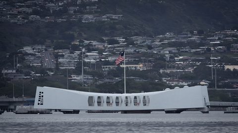 Pearl Harbor Reservations and the Bag Rule for a Respectful Half Day
Pearl Harbor bans bags inside the memorial, and free USS Arizona tickets vanish fast. Here is how we handled the bag rule and booked a respectful half-day.
Pearl Harbor Reservations and the Bag Rule for a Respectful Half Day
Pearl Harbor bans bags inside the memorial, and free USS Arizona tickets vanish fast. Here is how we handled the bag rule and booked a respectful half-day.
-
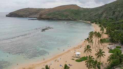 Hanauma Bay Reservation and Snorkelling Without Trashing the Reef
Hanauma Bay requires a timed reservation booked days ahead, and walk-ins are turned away. Here is how we got tickets and snorkelled without damaging the reef.
Hanauma Bay Reservation and Snorkelling Without Trashing the Reef
Hanauma Bay requires a timed reservation booked days ahead, and walk-ins are turned away. Here is how we got tickets and snorkelled without damaging the reef.
-
 Diamond Head Reservation and Hike the Heat the Crowd and the View
The Diamond Head hike delivers a postcard crater-and-coast panorama but demands an advance reservation, an early start, and a tolerance for exposed switchbacks and summit crowds.
Diamond Head Reservation and Hike the Heat the Crowd and the View
The Diamond Head hike delivers a postcard crater-and-coast panorama but demands an advance reservation, an early start, and a tolerance for exposed switchbacks and summit crowds.
-
 The Honolulu Travel Hacks We Actually Still Use After Dropping All the Internet Nonsense
Most Honolulu travel hacks are recycled filler. These are the few we have tested across multiple trips and still use every time we land on Oahu.
The Honolulu Travel Hacks We Actually Still Use After Dropping All the Internet Nonsense
Most Honolulu travel hacks are recycled filler. These are the few we have tested across multiple trips and still use every time we land on Oahu.
-
 Sleeping Well in a Honolulu Hotel Room When the Air Conditioner, the Roosters, and the Jet Lag All Conspire Against You
Honolulu hotels have specific enemies of sleep: feral roosters, cycling AC units, and brutal jet lag. Here are ten fixes that actually work in Waikiki.
Sleeping Well in a Honolulu Hotel Room When the Air Conditioner, the Roosters, and the Jet Lag All Conspire Against You
Honolulu hotels have specific enemies of sleep: feral roosters, cycling AC units, and brutal jet lag. Here are ten fixes that actually work in Waikiki.
-
 How We Stopped Taking Too Many Travel Photos and Started Taking Better Ones in Honolulu
We used to take thousands of near-identical Honolulu photos and remember nothing. Here is the simple system that finally fixed it for two photo-obsessed people.
How We Stopped Taking Too Many Travel Photos and Started Taking Better Ones in Honolulu
We used to take thousands of near-identical Honolulu photos and remember nothing. Here is the simple system that finally fixed it for two photo-obsessed people.
-
 Is Cruising for You After a First Time Out of Honolulu
Boarding a cruise ship in Honolulu for the first time as a sceptic, I found the reality of the embarkation, the cabin, and the rhythm at sea nothing like I expected.
Is Cruising for You After a First Time Out of Honolulu
Boarding a cruise ship in Honolulu for the first time as a sceptic, I found the reality of the embarkation, the cabin, and the rhythm at sea nothing like I expected.
-
 Planning a Week on Oahu and How We Would Split It Now
A week on Oahu splits best when you stop trying to see it all. Here is how we would divide seven days across Honolulu, the Windward side, and the leeward coast without the rush.
Planning a Week on Oahu and How We Would Split It Now
A week on Oahu splits best when you stop trying to see it all. Here is how we would divide seven days across Honolulu, the Windward side, and the leeward coast without the rush.
-
 Whale Watching from Honolulu and Managing Your Expectations
Whale watching from Honolulu depends entirely on the month, the boat, and your tolerance for long stretches of empty water. Here is what the season actually delivers.
Whale Watching from Honolulu and Managing Your Expectations
Whale watching from Honolulu depends entirely on the month, the boat, and your tolerance for long stretches of empty water. Here is what the season actually delivers.
Common Questions
Is the circle-island drive worth doing anticlockwise?
Yes. Going anticlockwise from Honolulu keeps you closest to the ocean on the windward side and puts the sun behind you during the afternoon leg through the leeward coast. You also hit the windward attractions before the crowds arrive from the other direction.
How long does the Kaena Point hike take from the south side?
The walk is roughly 5 miles round trip across sand and rock with no shade. Budget two and a half to three hours including time at the point. Start before 9 AM to avoid the midday heat.
Can you swim at Kaena Point?
No. The shoreline at Kaena Point is rocky and the current is dangerous. The point is for walking and wildlife viewing, not swimming. The nearest safe swimming beach on the leeward side is Makaha Beach Park, south of the trailhead.
What is the best snorkelling alternative to Hanauma Bay that does not require a reservation?
Kahe Point Beach Park, known as Electric Beach, on the Waianae coast. Free entry, no reservation, and the warm water discharge attracts fish year round. Shark’s Cove at Pupukea on the North Shore is another strong alternative, but it is only safe in summer when wave heights drop to 0 to 4 feet.
Which Waikiki recommendations should I ignore and which should I keep?
Skip the International Market Place, which was rebuilt as generic luxury retail, and the chain stores along Kalakaua Avenue between Lewers and Royal Hawaiian Avenue. Keep Duke’s Waikiki barefoot bar for the Hula Pie, the sunrise swim at Kuhio Beach before 7 AM, and the Royal Hawaiian Mai Tai Bar for one drink at sunset.
Read next
-
 Oahu Hotels the Resort Fee Parking Bill and Room View Arithmetic
Oahu hotels advertise one rate and charge another. We break down the resort fees, parking bills, and view-category fine print so the arithmetic is clear before you book.
Oahu Hotels the Resort Fee Parking Bill and Room View Arithmetic
Oahu hotels advertise one rate and charge another. We break down the resort fees, parking bills, and view-category fine print so the arithmetic is clear before you book.
-
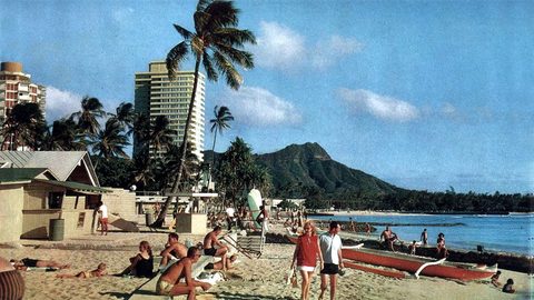 Where to Stay on Oahu Waikiki Ko Olina or the North Shore
Where to stay on Oahu comes down to three very different Hawaiis: the high-rise energy of Waikiki, the gated calm of Ko Olina, or the rural surf rhythm of the North Shore.
Where to Stay on Oahu Waikiki Ko Olina or the North Shore
Where to stay on Oahu comes down to three very different Hawaiis: the high-rise energy of Waikiki, the gated calm of Ko Olina, or the rural surf rhythm of the North Shore.
-
 Oahu Things to Do Beyond Waikiki That Are Worth the Drive
The best Oahu things to do sit well beyond the Waikiki high-rises: crater hikes, snorkel bays, surf towns, and a sunken battleship that requires a timed ticket.
Oahu Things to Do Beyond Waikiki That Are Worth the Drive
The best Oahu things to do sit well beyond the Waikiki high-rises: crater hikes, snorkel bays, surf towns, and a sunken battleship that requires a timed ticket.
-
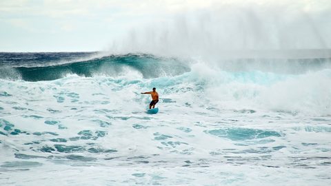 Best Time to Visit Oahu Surf Whales Rain and Room Rates
The best time to visit Oahu depends on whether you want winter surf and whales at peak prices, or calmer summer swimming with the family-holiday crowds.
Best Time to Visit Oahu Surf Whales Rain and Room Rates
The best time to visit Oahu depends on whether you want winter surf and whales at peak prices, or calmer summer swimming with the family-holiday crowds.
-
 Getting Around Oahu Rental Car TheBus and the Parking Problem
Getting around Oahu means choosing between a rental car that opens the island and a parking bill that stings, or TheBus which costs $3 and demands patience.
Getting Around Oahu Rental Car TheBus and the Parking Problem
Getting around Oahu means choosing between a rental car that opens the island and a parking bill that stings, or TheBus which costs $3 and demands patience.
-
 Eating on Oahu Plate Lunch Poke and the Places We Would Queue For
Eating on Oahu means plate lunches from a drive-in, poke sold by weight at a supermarket, and hot malasadas dusted in sugar from a bakery window on Kapahulu.
Eating on Oahu Plate Lunch Poke and the Places We Would Queue For
Eating on Oahu means plate lunches from a drive-in, poke sold by weight at a supermarket, and hot malasadas dusted in sugar from a bakery window on Kapahulu.
-
Pearl Harbor Reservations and the Bag Rule for a Respectful Half Day
Pearl Harbor bans bags inside the memorial, and free USS Arizona tickets vanish fast. Here is how we handled the bag rule and booked a respectful half-day.
-
Hanauma Bay Reservation and Snorkelling Without Trashing the Reef
Hanauma Bay requires a timed reservation booked days ahead, and walk-ins are turned away. Here is how we got tickets and snorkelled without damaging the reef.
-
Diamond Head Reservation and Hike the Heat the Crowd and the View
The Diamond Head hike delivers a postcard crater-and-coast panorama but demands an advance reservation, an early start, and a tolerance for exposed switchbacks and summit crowds.